Cities often find it difficult to use each other as models for stormwater infrastructure planning because of its inherently site-specific nature. Two identical copies of the same stormwater control measure (SCM), for example, might differ significantly in their performance based on their surrounding geography, the amount of rainfall they receive, and how their owners measure success. Even the terms by which different SCMs are defined can vary among different jurisdictions, complicating efforts to understand whether an SCM that works in one city will work in another.
A recent study published in Environmental Research: Infrastructure and Sustainability advances sectorwide efforts to enhance infrastructure information-sharing by building an inventory of SCMs currently operating in 23 U.S. cities that represent eight distinct climate types. The study, produced by researchers from six universities as well as the Water Research Foundation (Alexandria, Virginia) and the U.S. Geological Survey, attempts to identify meaningful patterns among the types of SCMs different cities pursue as well as the various physical, climatic, socioeconomic, and regulatory factors driving those choices.
“Cities have been shifting their approaches to stormwater management, with more cities using green stormwater management recently,” said Aditi Bhaskar, study co-author and University of Colorado Boulder environmental engineer. “To understand how all this relatively new green stormwater infrastructure is working, we need to know where it is. Our work contributes to sharing of information about what type of stormwater management is used where, in a way that other cities can understand the terminology used.”
Focusing on Function
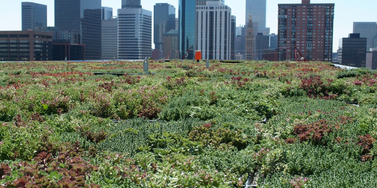
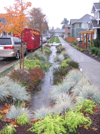
In 2021, the research team called on cities of all sizes to improve the way they document and share information about their SCM networks by focusing on their functions rather than their names. Following guidelines suggested in the Water Environment Federation (Alexandria, Virginia) Manual of Practice 23: Design of Urban Stormwater Controls, the researchers proposed a new set of terminology for different SCM categories based on their mechanics — green roofs became filters, for example, while permeable pavers became infiltrators. In this way, they condensed dozens of potential SCM types into just seven categories: basins, swales and strips, filters, infiltrators, gross pollutant traps, disconnection, and a miscellaneous catch-all category for other types. The researchers used this new nomenclature to create a more standardized database of the SCMs that exist in different cities. In their more recent study, the team sought a better understanding of why these types of SCMs were pursued.
Working closely alongside stormwater professionals in 23 cities with sufficient information about their SCM networks, the researchers compared the frequency and density of different SCM classes against an array of other city characteristics. These characteristics included, for example, the city’s average slope and proximity to the water table, as well as its typical climate, its population density, whether it contained combined or separate collection systems, and whether it was subject to a consent decree or other atypical regulatory requirements.
By drawing clearer connections among the types of common constraints that might make one type of SCM more cost-effective than another, the study attempts to help cities of all sizes chip away at the ambiguity of what makes a particular piece of infrastructure “site specific.” Other studies, as well as ongoing information-sharing partnerships between individual cities, have attempted to make these links clearer — but authors claim this study is the first to do so on a national scale. Clearer linkages will help smaller cities with less-established SCM networks identify larger cities as relevant models for infrastructure-planning decisions. They also can assist larger cities as they expand their SCM networks, particularly as pressures related to climate change and urban development shift the baseline set of assumptions that have guided their past decisions, Bhaskar explained.
“Cities with more resources can lead on advancing knowledge and practice by monitoring and evaluating SCM networks,” Bhaskar said. “These cities can also benefit from learning about the approaches used by other cities, for example, to share information on effectiveness of approaches.”
City Characteristics Inform Choices
Using statistical methods, researchers teased out several patterns that show which city characteristics hold the most sway over the types of SCMs they pursue.
In general, such physical considerations as the amount of impervious space in each city, its average slope, its distance to the water table, and its use of groundwater were the strongest determinants of the type of SCMs cities built. For example, cities that were not limited by a shallow water table generally chose infiltrators over basins, strips and swales, or filters, but infiltrators were far less common in lower-elevation cities. The infiltrators class included such SCMs as infiltration basins and vaults, trenches, dry wells, and permeable pavers. By contrast, such climatic variables as average precipitation and temperatures, aridity, and water-vapor pressures seemed to have little or no correlation with any particular type of SCM — a finding that surprised researchers.
Five out of the 23 cities were under U.S. Environmental Protection Agency consent decrees. Filters, a class that included sand filters, bioretention schemes, green roofs, and others, were markedly more common in these cities, the study finds. Filters were also implemented more frequently in cities with a greater percentage of regulated waterways classified as “impaired” as well as those that struggle with chronic combined sewer overflows. This finding could suggest that U.S. cities regard filters as the most reliable or cost-effective route to achieve regulatory targets related to water quality. Basins — such as wetlands, cisterns, and forebays — tended to be less common in cities with stricter regulatory obligations.
Results also underscored pronounced differences in the scale and diversity of urban SCM networks. For example, Los Angeles was found to maintain the lowest density of SCMs, with as few SCMs as 0.46/km2 (0.74/mi2) of impervious area, indicating a preference toward larger, regional interventions. Washington, D.C., on the other hand, operates as many SCMs as 314/km2 (505/mi2) of impervious area, demonstrating a more piecemeal approach. Some cities relied on only a few types of SCMs. With a high concentration of infiltration basins and no other SCM classes documented in the study, the City of Pocatello, Idaho, was the most extreme example. By contrast, Baltimore boasted the highest SCM diversity, containing an eclectic range of basins, filters, and infiltrators.
Read the full study, “Assessing stormwater control measure inventories from 23 cities in the United States,” in Environmental Research: Infrastructure and Sustainability.
Top image courtesy of U.S. Environmental Protection Agency

ABOUT THE AUTHOR
Justin Jacques is editor of Stormwater Report and a staff member of the Water Environment Federation (WEF). In addition to writing for WEF’s online publications, he also contributes to Water Environment & Technology magazine. Contact him at jjacques@wef.org.