New visualization tool mixes FEMA data with video-game technology to model flood damages before they occur

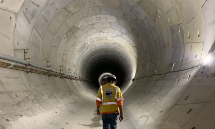
A collaboration between Stantec (Ontario, Canada) and the U.S. Federal Emergency Management Agency has resulted in a state-of-the-art visualization tool that lets users explore the effects of potential flood events in their specific neighborhoods. The tool is based on the Unreal Engine, one of the most widely used programming platforms for video-game designers. arembowski/Pixabay
The U.S. Federal Emergency Management Agency (FEMA) offers a long list of tools and datasets to help U.S. residents understand their specific property’s risk of experiencing severe flooding. However, terms like 100-year flood and storm surge do little to help users visualize the real-world effects of flooding on homes, vehicles, and other possessions. A floodplain map can help a property owner understand whether they should expect flooding from heavy rainstorms to occur, but not when, how often, or how much.
Meanwhile, anybody who has played a high-budget video game released within the last few years knows that the level of detail offered by today’s computer-graphics technology can border on the lifelike.
What if FEMA had a tool that borrowed from the world of video games to bring flood-risks to life?
Disaster prevention meets virtual reality
When Hurricane Florence tore across the Carolina coast last September, The Weather Channel released a video that used three-dimensional graphics to illustrate the potential intensity of storm-surge flooding for its viewers. The video, which depicts floating cars, submerged street signs, and widespread debris on an otherwise quiet suburban block, has been viewed nearly 2.5 million times.
One of those viewers worked for FEMA Region VII, which serves Iowa, Kansas, Missouri, and Nebraska. The agency consulted the Visualization Technology (VT) group of Stantec. This team includes filmmakers, animators, modelers, and graphical engineers, who previously developed visual tools to conceptualize new roads, bridges, and parks before their construction.
“FEMA asked us for an unconventional product that required an innovative solution,” said Chuck Lounsberry, who leads Stantec’s VT group. “They asked us to visualize the impact of flooding on a human, personal level while having the ability to relay information based on regional data.”
The team turned to an old standard in video-game development: the Unreal Engine. Used as the foundation for hundreds of top-grossing games since the release of its first version in 1998 — including such recent blockbusters as Fortnite and Borderlands 3 — Unreal Engine provides an open-access suite of tools that simplify the process of programming highly demanding graphical sequences. Besides video games, the engine has been used by realtors to offer virtual-reality home tours, by automobile manufacturers in car commercials, and in countless other applications.
“This engine lets us build environments that transport you to a very specific world on demand – much like a video game. The only difference with this tool is that the ‘world’ you’re seeing communicates flood data,” Lounsberry said.
Proving the concept
A prototype of the tool is already complete. It draws local and regional data from FEMA’s Risk MAP program, including terrain contours, aerial imagery, building footprints, and water-surface elevation grids, to create a representation of a specific neighborhood. Users can simply input an address into the system to explore firsthand how that address may fare under different levels of flooding.
The VT group trialed the prototype on two neighborhoods in low-lying Clive, Iowa, a 3.1-km2 (1.2-mi2) area that has experienced chronic flooding in recent years. Videos produced using the tool show an astounding level of detail:
- In a Starbucks Coffee parking lot, sudden, torrential rainfall sinks cars and overwhelms the storefront within hours.
- In a residential area, the view from the inside of a living room shows water levels rising steadily above the sidewalk.
With further development, FEMA and the VT team expect the tool to be able to model nearly any address in the U.S., Lounsberry said.
“Since this tool was built for FEMA, the tool has the capability to model the data they have available, which is very extensive in the U.S. Essentially, wherever FEMA goes, this tool can follow in mapping environments.”
Visit the Stantec website for more information about its flood-modeling tool for FEMA.