Image provided by the U.S. Environmental Protection Agency
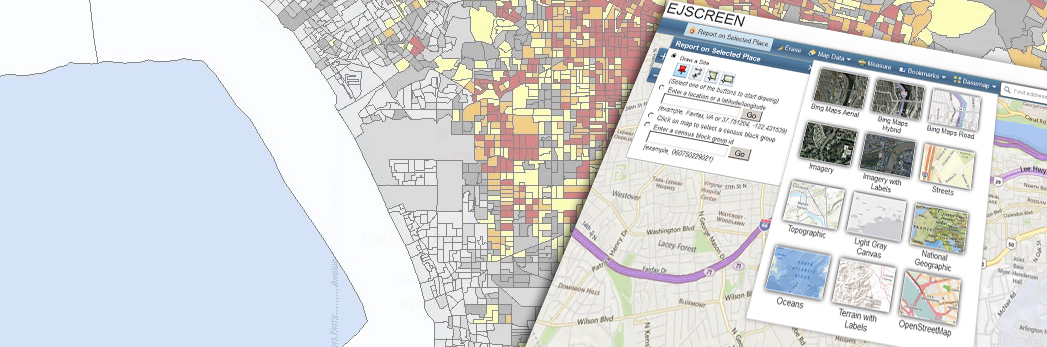
A new tool from the U.S. Environmental Protection Agency (EPA) allows users to locate areas with potentially elevated environmental burdens and vulnerable populations. Named EJSCREEN, the environmental justice screening and mapping tool applies demographic and environmental data to high-resolution mapping to identify communities at greater risk to pollution exposure.
EPA’s tool is based on eight pollution and environmental indicators — such as particulate matter and proximity to traffic and superfund sites — that are combined with U.S. Census Bureau American Community demographic data. Users can access color-coded maps, bar charts, and reports identifying minority or low-income populations that also face potential pollution issues.
EJSCREEN is anticipated to help governments and other organizations better understand areas in need of increased environmental protection, health care access, housing, infrastructure improvement, community revitalization, and climate resilience. By doing so, more effective environmental programs could be developed.
EPA Administrator Gina McCarthy said the new tool provides information to anyone seeking greater visibility and awareness about the effects of pollution in American communities.
“EJSCREEN has been a valuable resource for EPA to advance our commitment to protect Americans most vulnerable to pollution,” McCarthy said. “I’m excited to share this tool with the public to broaden its impact, build transparency, and foster collaboration with partners working to achieve environmental justice.”
The EPA plans to collect feedback on the datasets and design of the tool and plans to release a revised version next year.


