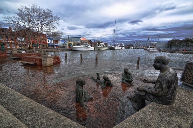
Annapolis, Md. nuisance flooding in 2012. Image Credit: Amy McGovern
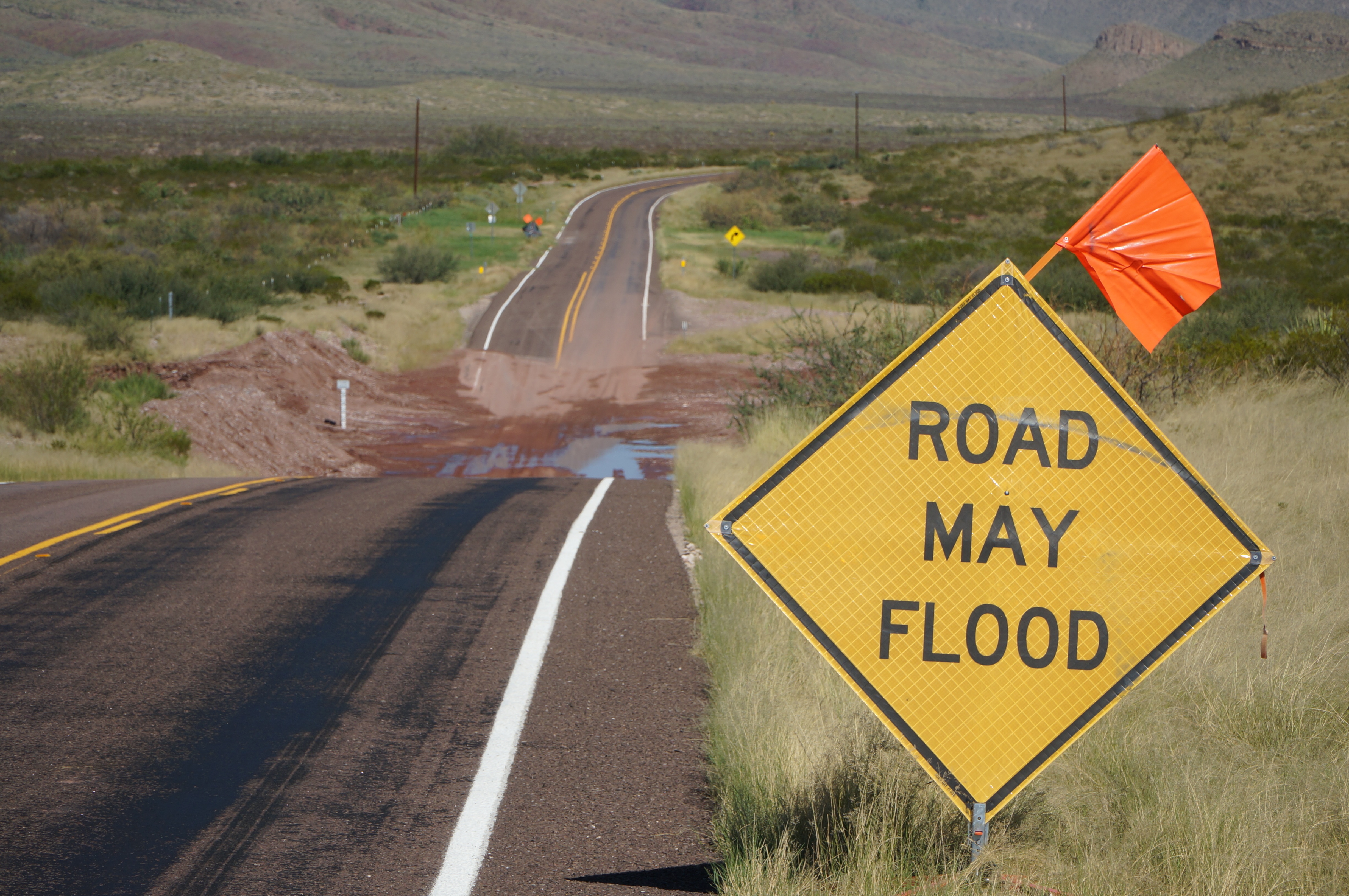
A National Oceanic and Atmospheric Administration study looking at more than 60 years of coastal water level and local elevation data changes finds that nuisance flooding is an increasing problem as coastal sea levels rise. Nuisance flooding causes public inconveniences, such as frequent road closures, overwhelmed storm drains, and compromised infrastructure. Most of the cities affected are on the east coast, with Annapolis and Baltimore in Maryland experiencing the greatest increases in nuisance flooding, according to the report released in July. However, all U.S. coasts are affected, with increases ranging between 300% and 925% compared to 1960s levels.
Beyond nuisance flooding, climate change also increases the risk of more serious events. On July 23, the National Research Council released a report supporting a national vision to address coastal risks. According to report authors, a national perspective is needed to achieve the most benefits from federal investments and provide regional solutions, rather than piecemeal, project-by-project approaches. The report urges a vision that includes a long-term view, regional solutions, and recognition of the full array of economic, social, environmental, and safety benefits that come from risk management. To support this vision, the council recommends a national coastal risk assessment to identify coastal areas facing the greatest threats and the highest priorities for risk-reduction efforts.
According to the report, responsibilities for coastal risk reduction are spread over a number of federal, state, and local agencies, with no central leadership or unified vision. The financial burden associated with coastal storms falls largely on the federal government, and the vast majority of funding is provided only after a disaster occurs. Funding is limited for mitigation, preparedness, and planning, and little attention has been directed at prioritizing efforts at national or regional scales to better prepare for future disasters. In addition, builders and developers bear almost none of the risk, and local and state governments, which rely upon the tax revenues of coastal development, have few incentives to limit initial development or post-disaster rebuilding in hazardous areas, the report says. Read more.
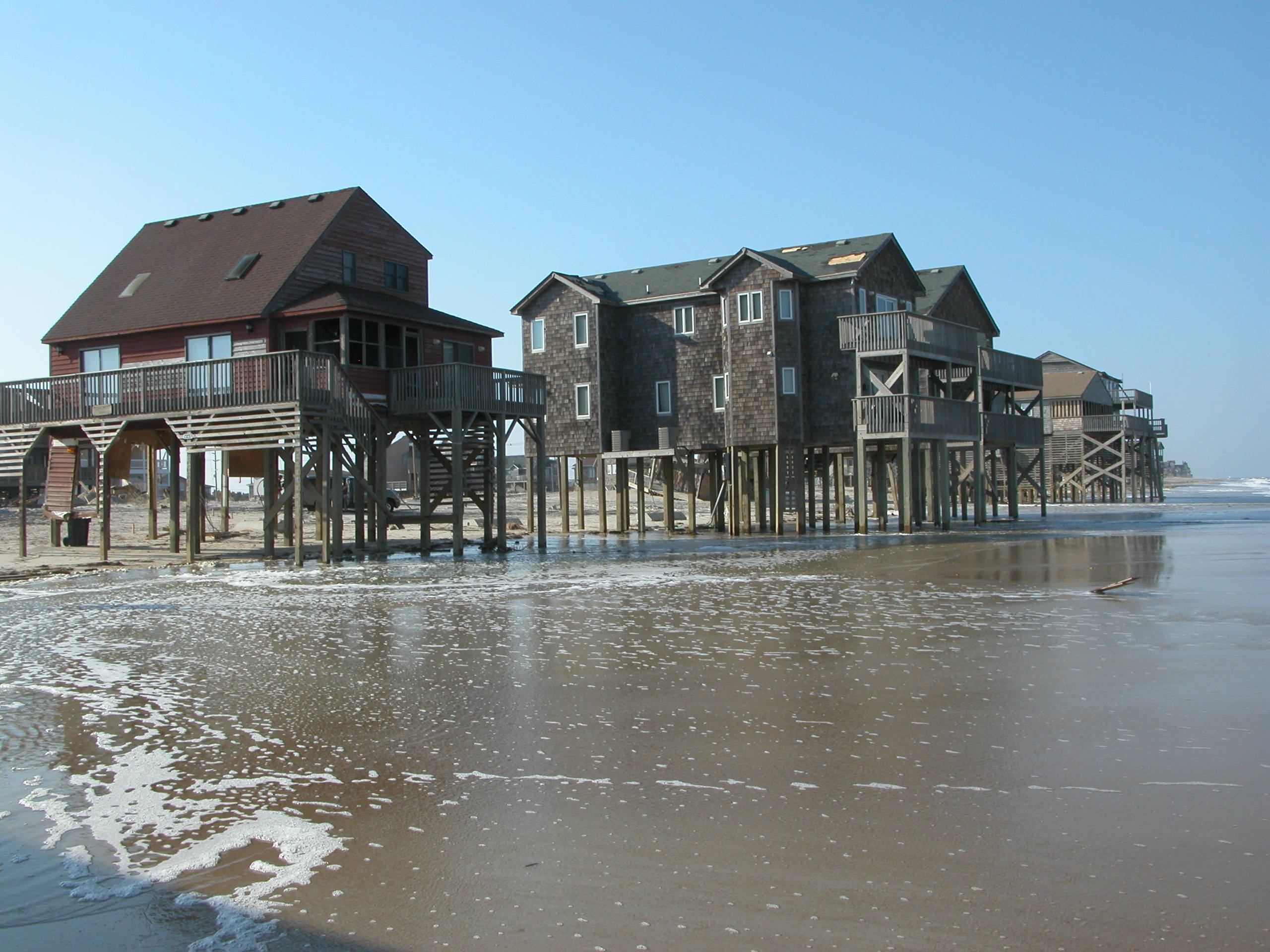
Houses in Rodanthe, NC, are left in the waves at the ocean’s edge following the passage of Hurricane Isabel, which made landfall as a category 2 storm in the Outer Banks on September 18, 2003. U.S. Geological Survey/photo by Hilary Stockdon
At the national level, federal agencies are working on tools and resources for communities. In mid-July, the U.S. Geological Survey launched the Coastal Change Hazards portal, which organizes products and information under three themes: severe storms, shoreline change, and sea-level rise. Users can enter their location to see maps and imagery of the effects caused by different storm scenarios. The Coastal Vulnerability Index feature also shows the relative susceptibility of US coasts to sea-level rise, which as discussed above, can affect nuisance flooding and a host of other issues. Read more.