When Hurricane Harvey inundated eastern Texas late last August, the eye of the storm loitered over land for nearly a week rather than dispersing as it moved farther from the ocean, as most hurricanes do. The result was a stronger, more destructive storm, which dropped a record-breaking 127 cm (50 in.) of rain and directly killed more than 65 people.
According to U.S. National Oceanic and Atmospheric Administration (NOAA) researcher James Kossin, Harvey’s sluggish pace — and its devastation — may soon become more commonplace.
Hurricanes moving slower as the tropics get warmer
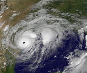
When most hurricanes make landfall, they tend to dissipate as they move further from the ocean. In August 2017, Hurricane Harvey stalled over eastern Texas for nearly a week, causing record-breaking destruction, flooding, and loss of life. U.S. National Aeronautics and Space Administration/U.S. National Oceanic and Atmospheric Administration.
Kossin studied about 70 years of NOAA hurricane data to compare travel speed (called “translational speed”), wind intensity, and rainfall patterns among storms. In 1949, the average pace of all hurricanes recorded around the world was 19 km/h (12 mi/h). By 2016, that average had dropped to 17 km/h (10.5 mi/h).
While specific slowdown rates fluctuate among regions, Kossin says hurricanes today travel about 10% slower on average than they did in 1949. The slowdown corresponds to a 10% increase in rainfall, heightened risks of flooding, and more intense and prolonged winds.
Coupled with the anticipated effects of climate change, slower storms could dramatically influence how much rain falls in a given area. Warmer climates mean moister clouds and wetter storms.
“Just a 10% slowdown in hurricane translational speed can double the increase in rainfall totals caused by 1° Celsius of global warming,” Kossin said.
Weaker winds mean stronger storms
Coastal areas in China, Japan, and Southeast Asia saw the most significantly slowed hurricanes at about 20% over the study period. Hurricanes affecting the east coast of North America slowed by about 6%. However, when Kossin isolated hurricane speeds for only the time they spend traveling over land, those averages jumped to 30% slower and 20% slower, respectively.
Hurricane movement is guided by strong winds located in the lower-most layer of the atmosphere. Prior studies have shown that global warming can weaken these winds, particularly during summertime in the tropics, when and where hurricanes form most often. Kossin argues that progressively weakening steering winds could be in large part to blame for the slower storms.
Kossin’s study marks the first to analyze hurricane speeds at the global level.
The new normal
In May, scientists with the U.S. National Center for Atmospheric Research (NCAR) visualized what 22 recent U.S. hurricanes might look like if they had formed under the warmer global climate predicted for the final years of the 21st century. In line with Kossin’s findings, the researchers surmised that most hurricanes would move slower over land, resulting in an average 24% more rainfall than today’s storms.
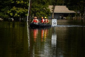
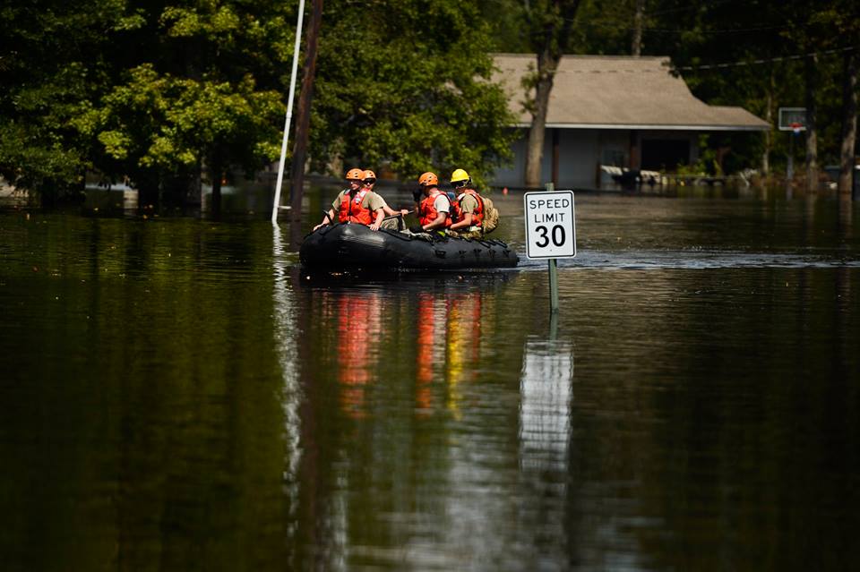
Researchers predict that slower, wetter, and more destructive hurricanes will become more commonplace as the 21st-century progresses and the effects of climate change become more apparent. Joshua L. DeMotts/U.S. Air Force.
“Our research suggests that future hurricanes could drop significantly more rain,” said study leader Ethan Gutmann, an NCAR scientist. “Hurricane Harvey demonstrated last year just how dangerous that can be.”
The study points to Hurricane Ike, which killed more than 100 people along the Gulf Coast in 2008, as an example. Simulations of the hurricane based on an average of climate-change predictions found that the same storm would have 13% stronger winds, move 17% slower, and drop 24% more rain if it occurred closer to the year 2100.
Notably, predictions were not uniform. The high-resolution climate and weather simulation, which used a new NCAR dataset and took about a year to render on a computer, projected some hurricanes to have weaker winds or move slightly faster than modern-day storms. Each of the 22 simulated storms, however, showed more intense rains with higher frequencies.


