In many cities, aging combined sewer infrastructure has not kept pace with the need generated by expanding concrete landscapes and a changing climate that promises more intense rainstorms. In the WEFTEC® 2013 host city of Chicago, several storms in recent years have reportedly dropped more than 5 cm (2 in.) of rain in a single hour, much more than the city’s collection system was originally designed to accommodate.
In addition to upgrading sewer infrastructure, Chicago is working to keep runoff from reaching sewers. The city has become a leader in innovative stormwater management with more than 360 green roofs and a Sustainable Backyards Program that has issued more than 420 rebates for trees, rain barrels, and more. At WEFTEC, Chicago Mayor Rahm Emanuel announced $50 million over 5 years for green stormwater infrastructure.
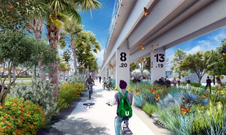
During the conference, attendees had the opportunity to examine some of Chicago’s green infrastructure elements, touring sites that demonstrate what the streets and alleys of the future might look like. The tour also stopped at Northerly Island, a man-made island that will be the future site of a 37-ha (91-ac) urban nature preserve.
Streets of the Future
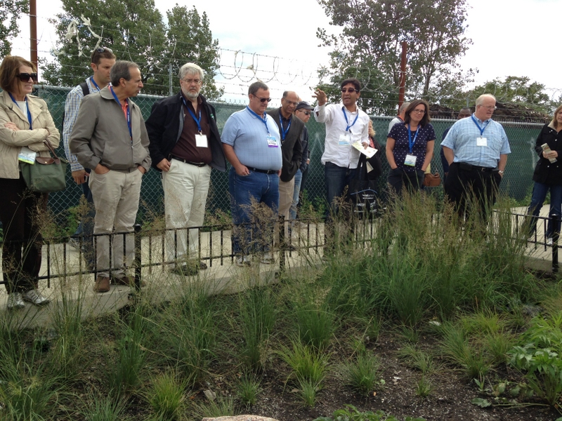
Kuldip Kumar with the Metropolitan Water Reclamation District of Greater Chicago explains how the Cermak-Blue Island Sustainable Streetscape Project is monitored.
With 70% of the city’s public space in transportation right-of-way limits, the Chicago Department of Transportation (CDOT) is playing its part in managing stormwater and increasing Chicago’s overall sustainability.
“Sustainability is inherently a 3D problem,” said David Leopold, program manager with CDOT’s Streetscape and Sustainable Design Program. Issues go beyond stormwater to emissions, water conservation, public health, and more, so sustainability projects must fulfill multiple goals in limited urban spaces.
CDOT’s $14 million Cermak-Blue Island Sustainable Streetscape Project, which WEFTEC attendees toured on Oct. 5 and 9, incorporates eight sustainability performance areas. The first phase, completed in 2012, is a 2.4-km (1.5-mi) stretch of Blue Island Avenue and Cermak Road that boasts the title of America’s greenest street.
The street features native plants, recycled and local materials, and energy efficient kiosk lighting that is partly powered by wind and solar. High-albedo pavement reduces the urban heat island and photocatalytic cement helps remove nitrogen oxide from the air. The site also uses no potable water and prevents 80% of average annual rainfall from entering nearby combined sewers.
CDOT increased the street’s landscape and tree canopy cover by 131% with bioretention cells that extend along both streets and a bioswale that lines one side of Cermak Road. Blue Island Avenue also features permeable parking spaces and bike lanes that created a link in the bike network and addressed a safety problem. By moving parking in 152 cm (5 ft), drivers no longer felt the need to park on the sidewalk to avoid being sideswiped.
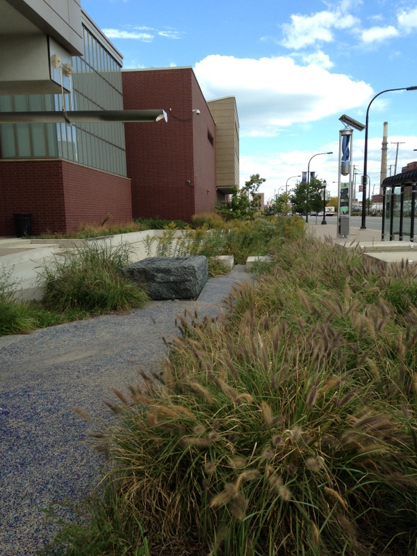
Runoff from the roof, street, and sidewalk drain into this water feature within the Cermak-Blue Island Sustainable Streetscape Project.
The project’s most visible stormwater feature is next to Benito Juarez Community Academy. Rain from the school’s roof and water infiltrated by the plaza’s permeable pavement drain into a water feature. Runoff from the streets is also captured as it flows into the bioretention area. All of this water moves toward the bioswales.
The city will maintain the planters for 2 years, and then a private partner will assume maintenance responsibilities. Some typical maintenance described during the tour includes removing the stones between the permeable paver blocks and sweeping the pavement twice a year. Trash and debris removal is also integral to the function of the planters. Designing the planters with rock catchment areas helps to reduce maintenance by slowing and cooling the water and reducing sediments and road salt. During planning, CDOT looked at about 100 different plant species, selecting those with high salt tolerance. When plants go dormant in the winter, businesses will call to complain about dead plants, said Leopold, so CDOT also factored this into their plant selection.
Part of the project is also determining how well green infrastructure elements work and gathering locally specific data to improve their performance across Chicago. For the last 2 years and another 3 years into the future, the Metropolitan Water Reclamation District of Greater Chicago (MWRDGC) and United States Geological Survey (USGS) will monitor rainfall and sewer flows. As part of the Cermak-Blue Island Sustainable Streetscape Project, USGS is collecting data at four groundwater monitoring wells in the project area. Groundwater swells after rain events indicate that the street’s green infrastructure has been working. MWRDGC is also looking at water quality via an automatic water sampler.
Alleys of the Future
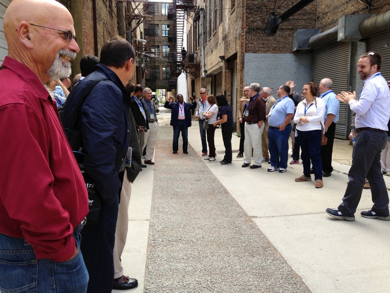
WEFTEC attendees examine one of Chicago Department of Transportation’s first green alleys.
In 2006, well before the completion of the Cermak-Blue Island Sustainable Streetscape Project, CDOT started its green alleys program with six pilot locations. There are now more than 200 green alleys in Chicago, with 20 to 40 built each year.
“Chicago has more alleys than any other city,” said Leopold. Chicago’s 13,000 alleys cover 1416 ha (3500 ac). “Alleys are part of the city’s culture. They offer some opportunity for experimentation and provide a space for addressing flooding.”
On the tour, WEFTEC attendees saw one of Chicago’s oldest green alley projects. For managing stormwater, the alley incorporated a strip of pervious concrete. The pervious pavement was made from a mixture that included recycled blast furnace slag. The system is closed on the sides while the bottom is open to the soil after 152 cm (5 ft) of recycled concrete aggregate. “This type of system is good for low thoroughfare areas with less than 300 vehicles per day,” Leopold said. Conventional pavement was also used in the wheel path to improve longevity.
In this early alley design, CDOT discovered that the width of the pervious paver strip was too small for the catchment area, so it often gets clogged in the top 13 mm (0.5 in.). “The ratio between the permeable and impermeable pavement is important in terms of maintenance,” Leopold said. Chicago’s green alley maintenance program involves a dry sweep two times per year with a conventional conveyer sweeper that employs a long-bristled brush.
Islands of the Future
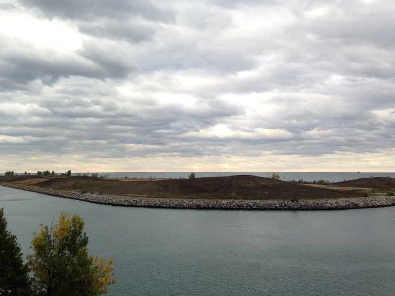
Northerly Island is a man-made island that will serve as the future site of a 37-ha (91-ac) urban nature preserve.
The last stop on the tour was the Chicago Park District’s Northerly Island Habitat Development project. Much of Chicago’s coastline along Lake Michigan has been filled in to make room for the city, which has pushed out into the lake. The sprawl even includes several man-made islands.
The northernmost island is called Northerly Island. Created in 1917 for the World’s Fair, this 37-ha (91-ac) island was later converted into an airport and is now a nature preserve. Currently, 16 ha (40 ac) of the island are under construction. Looking over this section, one sees mostly dirt hills, but by the spring of 2014 people will be able to camp on the island and enjoy a planned landscape that changes with the seasons. Sight lines will correlate with the winds, constellations, and solstices, and there will be a direct line to the sunrise and sunset. The island will provide a haven for north–south migrating birds with plants that bloom and fruit at various times of the year to coincide with their migration.
The island’s stormwater system will be disconnected from MWRDGC’s combined sewers. Runoff will travel by gravity to a 2-ha (4-ac) pond that is connected to Lake Michigan by a canal. The water level in the pond will fluctuate with the lake. To accommodate this flux, the island’s series of ecosystems — the oak savannah, prairie, mesic ecosystem, and wetlands — will overlap. Collected and filtered rainwater will be used to replenish the island’s landscape and wetland elements. Further, the wetlands will be home to the endangered mud-puppy salamander, which the public will be able to watch via the Shedd Aquarium’s underwater cameras.
The island will help reintroduce city residents to nature through its living classrooms. It is integrated with the museum campus through educational opportunities that build on the year-round programming of the Field Museum, Shedd Aquarium, and Adler Planetarium.
The island will also provide an eco-recreation component for visitors, with opportunities for snowshoeing, fishing, and more. A winding trail will connect the island to one of the busiest trails in the U.S. — the Lake Front Trail. Future man-made islands will open up opportunities for surfing, and the Chicago Parks District plans to build swimming platforms.
Funding for the Northerly Island project is being provided by the Great Lakes Restoration Initiative and the Army Corps of Engineers along with matching funds from the Northerly Island reserve, created by concert venue revenues.
According to Robert Foster with the Chicago Park District, most public acceptance issues center on safety concerns about mosquitoes, wild animals, and drowning. However, “the more projects we do, the more the perception is changing,” he said.