New York City experienced approximately USD $19 billion in damage and lost economic activity following Hurricane Sandy in 2012. The storm forced thousands of residents to evacuate from flooded homes, overwhelmed subway tunnels, and plunged much of Manhattan into darkness.
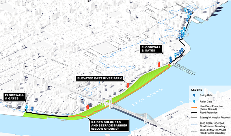
More than a decade later, in October 2024, New York City officials announced the completion of the first phase of the East Side Coastal Resiliency (ESCR) project, the largest urban resilience project currently underway in the United States. With a USD $1.45 billion budget, the project will reshape 4 km (2.4 mi) of Manhattan’s shoreline by 2026, changing the way New York City responds to extreme storms and rising sea levels.
A Multi-Pronged Plan for Flood Protection
The ESCR, designed with a 100-year lifespan, is an integrated system of raised parklands, berms, floodwalls, and adjustable floodgates designed to improve flood resilience along Manhattan’s Lower East Side. The project, which began in 2020, saw its first major milestone in February 2022 with the installation of a 13-m (43-ft), 14,500-kg (32,000-lb) swinging floodgate, the first of 18 floodgates expected to be installed by the project’s completion.
In addition to its protective measures, the ESCR project is prioritizing upgrades to local parks. For example, a new floodwall and sliding floodgate now intersect Asser Levy Playground, which has been partially rebuilt with extensive landscaping, new playground features, and basketball areas made from resilient materials.
“We are pioneering shoreline protection and climate change management for major North American cities and doing it in a way that enhances recreation and enhances neighborhoods instead of just walling them in,” said Thomas Foley, New York City Department of Design and Construction (DDC) Commissioner, in a release.
Work on the second phase is ongoing and introduces significant upgrades to the combined sewer system to mitigate inland flooding during heavy rainfall. The project will add new sewer lines that will enhance the system’s overall capacity and direct any excess water to the Manhattan Pump Station. It also will include a parallel conveyance system to ensure wastewater is transported to treatment facilities efficiently. To further improve flood management, the project calls for two underground interceptor gates at its northern and southern ends to block wastewater flows.
A Piece of the Puzzle
The ESCR is a significant part of a larger, multibillion-dollar flood resilience initiative covering all of Lower Manhattan. The Lower Manhattan Coastal Resiliency (LMCR) Project complements the ESCR and spans 5 km (3.1 mi) of New York City’s coastline.
Both the ESCR and LMCR projects stem from a post-Hurricane Sandy design competition which challenged architects to rethink coastal regions to address previous design mistakes. The winning design — called the BIG U, designed by Bjarke Ingels Group (New York) — proposed a 9-km (5.5-mi), horseshoe-shaped series of landscape projects encircling Lower Manhattan, integrating social infrastructure with flood protection. As time progressed, this concept developed into two separate projects: the ESCR and LMCR.
“The East Side Coastal Resilience Project is the first project that shows how large-scale coastal protection infrastructure and its associated stormwater management can be integrated into a complex urban environment in such a way that it has public space — and other benefits,” said Matthijs Bouw, Founder of ONE Architecture & Urbanism (New York). “It will become an example for the many similar projects that will have to be designed across the world in the next decades. Planning and designing a new category of infrastructure in already dense environments takes hard work by many actors: City agencies, local community organizations, consultants, experts and builders. It is extremely fulfilling to see the project being implemented now because it demonstrates that investments in collaboration pay off and deliver results.”
Building a Flood-Resistant Future
Currently in design and early construction phases, the LMCR project is a cornerstone of the original BIG U vision. It comprises four subprojects:
- the Brooklyn Bridge-Montgomery Coastal Resilience initiative, which will install a combination of flood walls and deployable flip-up barriers from the Brooklyn Bridge to Montgomery Street, incorporating public amenities like seating and fitness equipment and providing both protection and community engagement opportunities;
- the Battery Coastal Resilience Project, which aims to rebuild and elevate the deteriorating wharf promenade in Battery Park to withstand sea-level rise projections through 2100, utilizing salt-tolerant trees, enhanced drainage systems, and permeable pavers;
- Battery Park City Resilience, a multiphase project integrating flood-risk management systems across South, North, and West Battery Park City, focusing on preserving open spaces, enhancing access to waterfront views, and minimizing disruptions to existing infrastructure; and
- the Financial District and Seaport Climate Resilience plan, which addresses one of the city’s most flood-prone areas by extending Manhattan’s shoreline into the East River, incorporating continuous waterfront protection systems such as floodwalls and elevated landscapes.
The entire LMCR Project is projected to cost between USD $5 and $7 billion and see completion between 2040 and 2050.
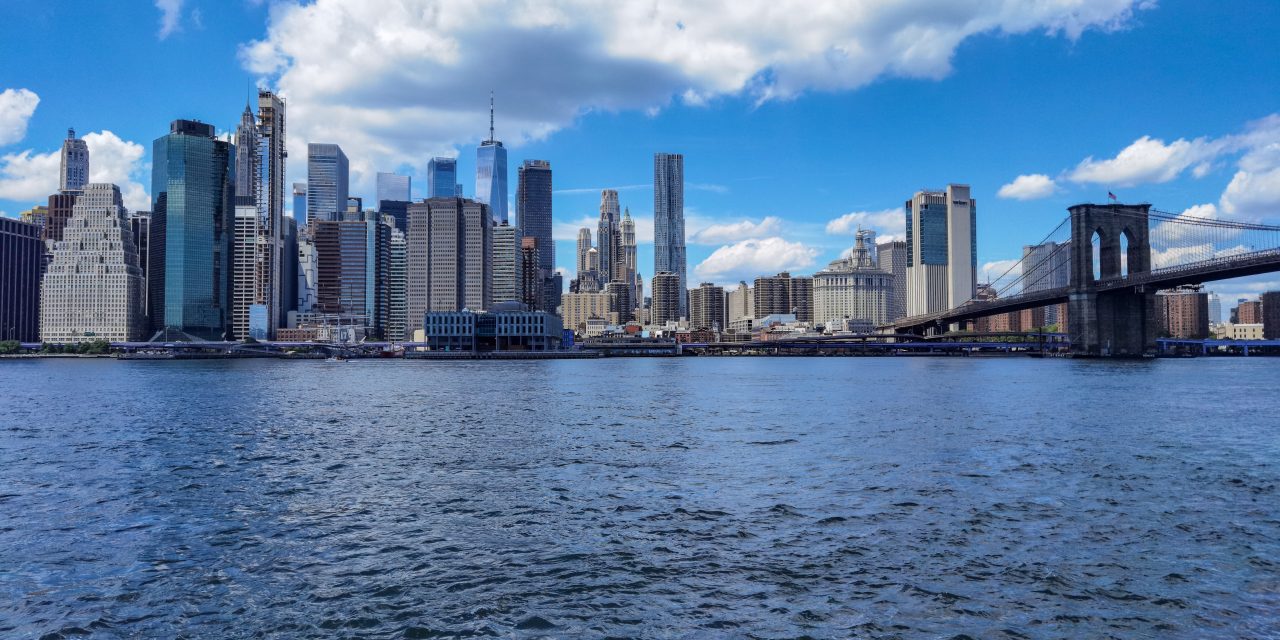
Top image courtesy of Sarowar Hussein/Pixabay

ABOUT THE AUTHOR
Michelle Kuester is a staff member of the Water Environment Federation, where she serves as Associate Editor of Stormwater Report and Water Environment & Technology magazine. She can be reached at mkuester@wef.org.

