The U.S. experienced 28 weather and climate disasters in 2023, exceeding the previous record of 22 set in 2020. With the regularity and intensity of these natural disasters on the rise, it is important that emergency managers, local decision makers, and scientists can quickly and effectively conduct damage investigations after extreme events. Speedy and thorough assessments not only have the potential to spare lives and infrastructure, but also can allow city planners and developers to make future buildings more resilient by informing trends in which buildings do — and do not — sustain damage.
Traditionally, disaster-relief professionals conduct damage assessments through field reconnaissance, which can be labor-intensive, costly, and hazardous. Moreover, severe damage often restricts access to the hardest-hit areas, leading to delays and other complications in field-based assessments.
To address these challenges, researchers at Florida Atlantic University (FAU; Boca Raton) have developed a new technique that leverages remote sensing technology to provide rapid, high-resolution damage assessments following natural disasters.
Testing Post-Hurricane Ian
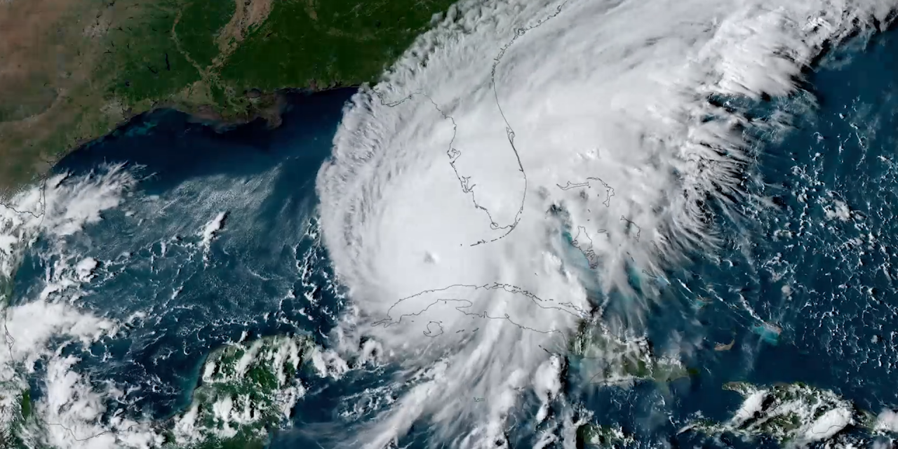
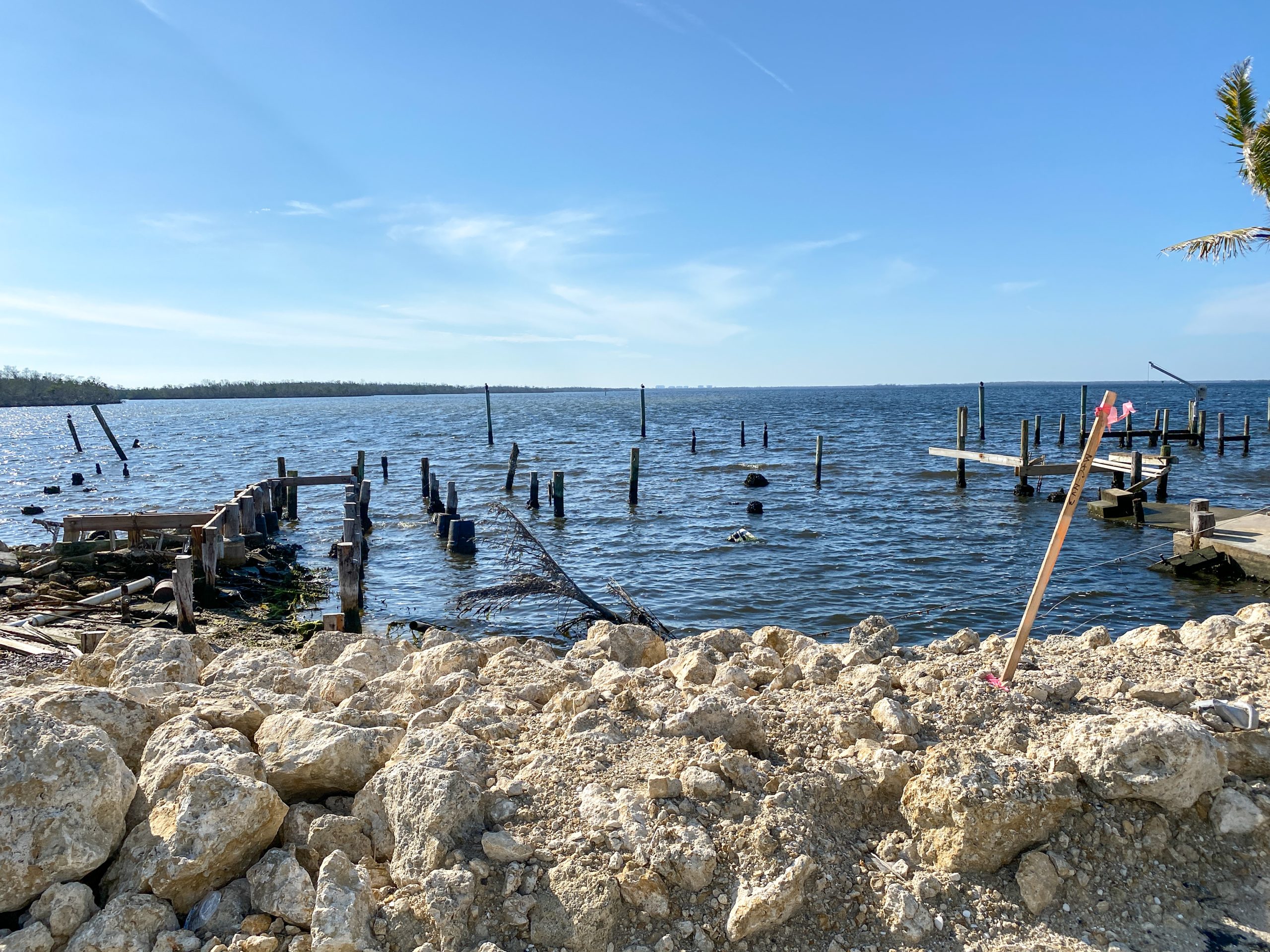
On September 28, 2022, Hurricane Ian, a Category 4 storm, made landfall in Lee County, Florida. With wind speeds reaching 250 km/h (155 mph) and storm surges up to nearly 4 m (13 ft) — the highest recorded in Southwest Florida in the past 150 years — the hurricane caused extensive damage.
By utilizing aerial imagery and data from LiDAR — a technology that uses laser beams to measure objects — FAU researchers identified the hardest-hit areas on Estero Island in Southwest Florida and estimated the extent of structural damage.
The results of the study, published in the Journal of Marine Science and Engineering, revealed that Hurricane Ian impacted a total of 2,427 structures on Estero Island, with 170 structures experiencing extensive damage. Using data from the Lee County tax appraiser, the researchers estimated the total assessed value of the heavily damaged structures at over USD $200 million.
“Employing aerial imagery and airborne LiDAR allowed us to collect extensive data from Hurricane Ian’s aftermath and analyze large-scale datasets quickly,” said Tiffany Roberts Briggs, Associate Professor in FAU’s Department of Geosciences, in a release.
Methodology and Broader Applications
To conduct the analysis, researchers combined assessments of beach changes, debris and sediment deposits, and structural damage using the U.S. National Oceanic and Atmospheric Administration’s (NOAA) Emergency Response Imagery and LiDAR data. LiDAR tools were used to extract building footprints and heights before and after the storm, enabling the team to overlay these footprints on post-storm imagery to estimate the number and extent of damaged buildings. This method quickly identified damage and examined the relationship between the hardest-hit areas and the pre- and post-storm landscape.
The Hurricane Ian case study demonstrated the potential of remote sensing data to revolutionize rapid post-storm assessments, significantly reducing the reliance on traditional field survey methods for collecting time-sensitive data.
“Although our study focused on Estero Island, this new approach is generalizable,” said Diana Mitsova, Professor in FAU’s Department of Urban and Regional Planning. “As technology advances and becomes more accessible, it will offer a broad range of high-resolution coverage to prioritize emergency response efforts following catastrophic natural disasters.”
The techniques employed can also be adapted to assess damage from other kinds of natural disasters, such as wildfires and earthquakes, explained Leanne Hauptman, Ph.D. student in FAU’s Department of Geosciences. By modifying certain parameters, the methodology of this study can aid efforts to build more resilient communities and environments in the future.
“The team is currently working on expanding this study… but also [will] continue to use this approach for future hurricanes and storm events in Florida,” said Hauptman.
Read the full study, “Hurricane Ian Damage Assessment Using Aerial Imagery and LiDAR: A Case Study of Estero Island, Florida,” in the Journal of Marine Science and Engineering.
Top image courtesy of NOAA Satellites

ABOUT THE AUTHOR
Michelle Kuester is a staff member of the Water Environment Federation, where she serves as Associate Editor of Stormwater Report and Water Environment & Technology magazine. She can be reached at mkuester@wef.org.