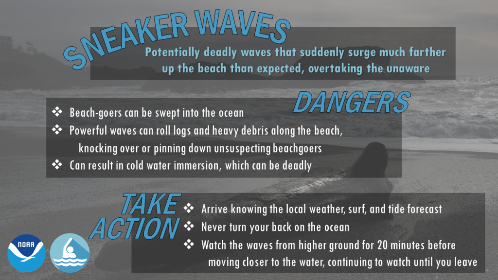
During the afternoon of January 16, 2016, a rare and destructive phenomenon affected several beaches along roughly 1,000 km (620 mi) of Northwest U.S. coastline. The ocean waves that normally break gently against the beachfront abruptly surged forward, moving as far as 100 m (330 ft) inland or more in a matter of minutes. At least five such waves were documented by beachgoers within the span of a few hours between Pacific Beach, Washington, and Humboldt Bay, California, and at least two serious injuries were reported.
These sneaker wave events — often described as “mini-tsunamis” — occur periodically at beaches around the world. However, unlike tsunamis, scientists have concluded that sneaker waves do not result from mid-ocean earthquakes or landslides. The specific factors that drive sneaker waves are poorly understood, which hampers efforts to predict and prepare for them.
New research published in the journal Natural Hazards and Earth System Sciences suggests that large-scale storm systems may have a major effect on sneaker wave formation. The study team, which includes researchers from Oregon State University (OSU; Corvallis), Pacific Northwest National Laboratory (Richland, Washington), and the U.S. National Weather Service (Portland, Oregon), describes that sneaker waves are the result of a complex interplay between topography, weather, and climate. The influence of storm systems hundreds of kilometers away from shore can make sneaker waves more likely to occur. Tuba Özkan-Haller, study co-author and OSU Oceanographer, expressed hope that her team’s findings can help protect people and property.
“The more we learn, the closer we get to our ultimate goal, which would be to develop a warning system that is specific, accurate, and localized,” Özkan-Haller said in a release.
Searching for a Signal
The spate of Northwest U.S. sneaker waves in 2016 was unique because of how thoroughly it was documented, researchers say. It occurred in the early afternoon on a clear day and was widely observed by locals who posted video footage of the sneaker waves online. Several local news outlets reported from affected beaches.
Researchers examined these videos closely, compiling subtle details of how the waves behaved alongside firsthand accounts from witnesses. The footage confirmed that while the number and strength of different sneaker waves varied based on their location, each wave surged inland and then retreated into the ocean abruptly.
“The videos showed important general characteristics of the [sneaker wave] events on this day — in particular that they were roughly 5 minutes from beginning to end,” said lead author Chuan Li, who participated in the study as an OSU doctoral student. “This information helped us identify their signals from tide gauges and also helped narrow down possible causes.”
The next phase of the team’s investigation relied on three distinct types of U.S. National Ocean and Atmospheric Administration (NOAA) ocean sensors.
- Tide gauges, which are located along shallow coastlines, provide minute-by-minute data on water level, wind speed, and atmospheric pressure.
- Data buoys take hourly wave height, wave speed, and wave energy readings in deeper waters, approximately 30 to 85 km (18 to 53 mi) offshore.
- Bottom sensors are used to detect tsunamis and measure water-column height, located as low as 4,319 m (14,169 ft) beneath the waterline and as far as 556 km (345 mi) into the ocean.
Comparing this data alongside video footage and eyewitness reports from different locations along the coast helped researchers understand how and where sneaker waves form and travel, as well as identify signals that a sneaker wave might be on its way inland.
New Insights on Sneaker Waves
The investigation confirmed that winter conditions in the Pacific Northwest make the region particularly susceptible to sneaker waves.
In their study, researchers distinguish between two types of wave systems: surface gravity waves, which are those typically seen by beachgoers, and infragravity waves, which are larger, stronger wave regimes that lurk deeper beneath the waterline. The intensity of these infragravity waves dictates the behavior of the surface gravity waves above them, including their frequency, height, and strength.

When large storm systems form in far-off ocean waters, such as those near Alaska or the South Pacific, stronger winds add energy to infragravity wave systems. In turn, this influx of energy causes surface gravity waves to space out, becoming less frequent but reach greater heights and faster movement speeds. During the winter storm season, nearshore waves tend to reach approximately twice the average height that they reach in summer, the researchers write.
These taller waves are more likely to become sneaker waves when they encounter beaches in areas where the continental shelf is narrow — in other words, flat, low-sloping beaches that offer less resistance to the inland flow of water. These types of beaches make up the majority of those located along the Pacific Northwest coastline, according to the study. With sufficient energy granted by storm systems with sufficient intensity, tall surface gravity waves become long and strong enough to avoid breaking against the beachfront.
“The longer the wave is, the less likely it is to break,” Özkan-Haller said. “Instead, it sloshes up, like the water would if you’re getting into a bathtub.”
However, researchers also found that weather along the coast is just as important as storm systems in far-off ocean waters. Evidence suggests that winter storms near beachfronts tend to dampen the energy of incoming waves, discouraging strong waves from surging into sneaker waves, Özkan-Haller explained. The clear conditions along the Northwest U.S. on January 16, 2016 — which contrasted with a strong storm system near Alaska’s Aleutian Islands — made the region highly susceptible to sneaker waves.
“If these long waves are forming out in the ocean, but there is also a local storm, the wave field is jumbled, and sneaker waves won’t occur,” Özkan-Haller said. “When the wind is calm, the local weather is mild – a beautiful day on the beach – sneaker waves are more likely.”
Read the full study, “Observations of extreme Wave Runup Events on the US Pacific Northwest Coast,” in Natural Hazards and Earth System Sciences.
Top image courtesy of StockSnap/Pixabay

ABOUT THE AUTHOR
Justin Jacques is editor of Stormwater Report and a staff member of the Water Environment Federation (WEF). In addition to writing for WEF’s online publications, he also contributes to Water Environment & Technology magazine. Contact him at jjacques@wef.org.


