As the U.S. Environmental Protection Agency (EPA) begins to focus on stricter regulations to deter industrial stormwater pollution as one of its National Enforcement Initiatives for the next 3 years, administrators of large industrial properties may want to consider new solutions to maximize the efficiency of their runoff management systems.
Emerging technologies — such as cloud computing and geographic information system (GIS) mapping — offer ways for industrial stormwater managers to gather and interpret data as never before possible. Whether planning new infrastructure, optimizing existing infrastructure, or navigating regulatory requirements, stormwater professionals can save valuable time, effort, and funds by embracing new technologies.
Exploring new possibilities
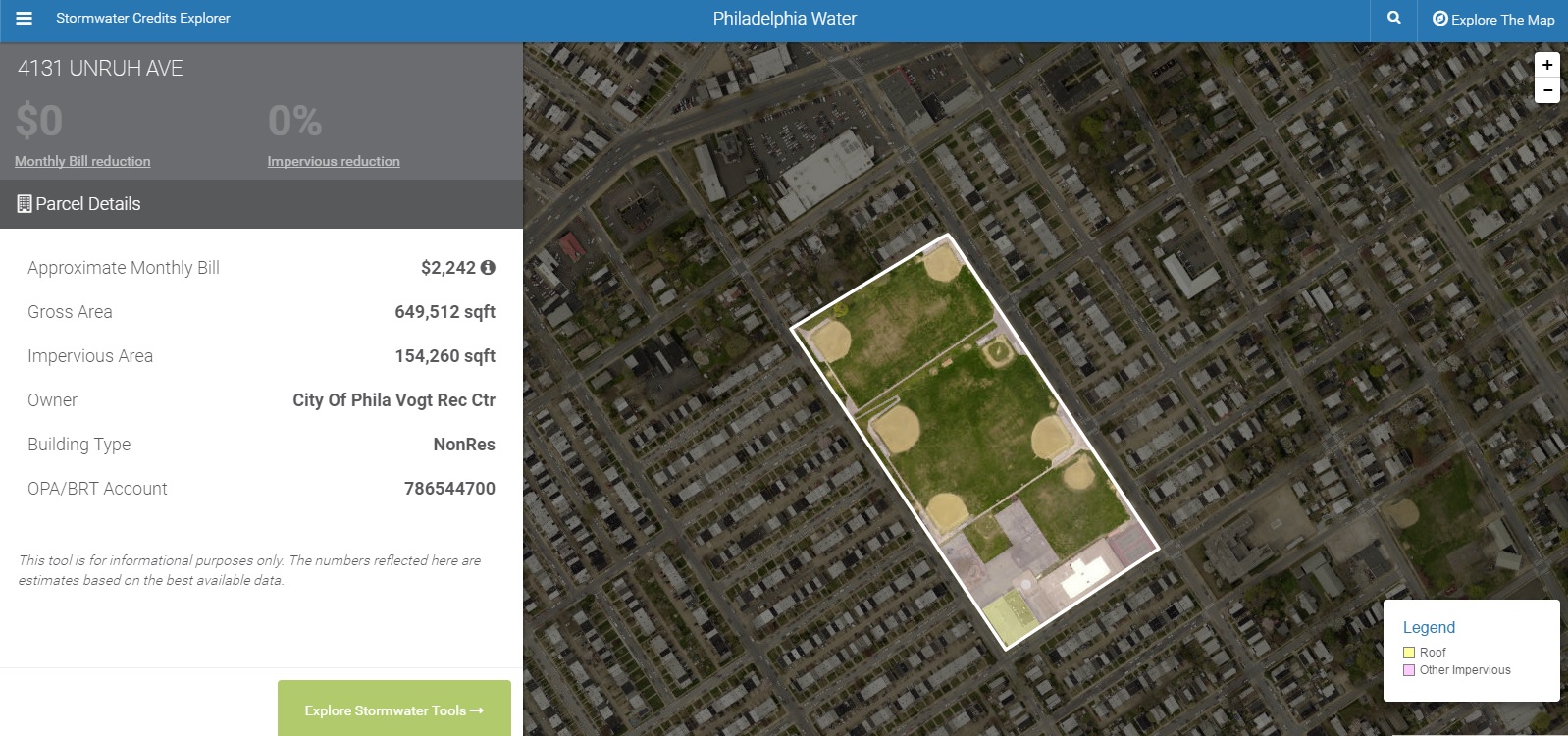
Based mainly on surface permeability, the Stormwater Credits Explorer from Philadelphia Water (Penn.) estimates that the Vogt Recreation Center at 4131 Unruh Ave. pays about $2,242 each month for stormwater management, for example.
Photo credit: Philadelphia Water
The ability to visualize the potential benefits of new green infrastructure projects before construction is not new, but without precise knowledge of the construction area, estimating the effect of new projects on runoff levels can be complicated and inaccurate. For example, users of EPA’s National Stormwater Calculator can estimate the amount and frequency of stormwater runoff from any point in the U.S., but the user first must know the lot’s percentage of impervious cover, its soil type, and other hard-to-pinpoint variables.
In June 2015, Philadelphia Water (Penn.) launched the Stormwater Credits Explorer app. Using a browser-based platform, owners of commercial and industrial properties in Philadelphia can “draw” ideas for green infrastructure projects directly onto a bird’s-eye-view map of their lot.
Because the City of Philadelphia currently levies non-residential stormwater management fees based on the percentage of impermeable surface on each property, Credits Explorer uses accurate, localized data to estimate how new green infrastructure projects can affect the property’s surface permeability – and the amount its owners can save each month on stormwater fees.
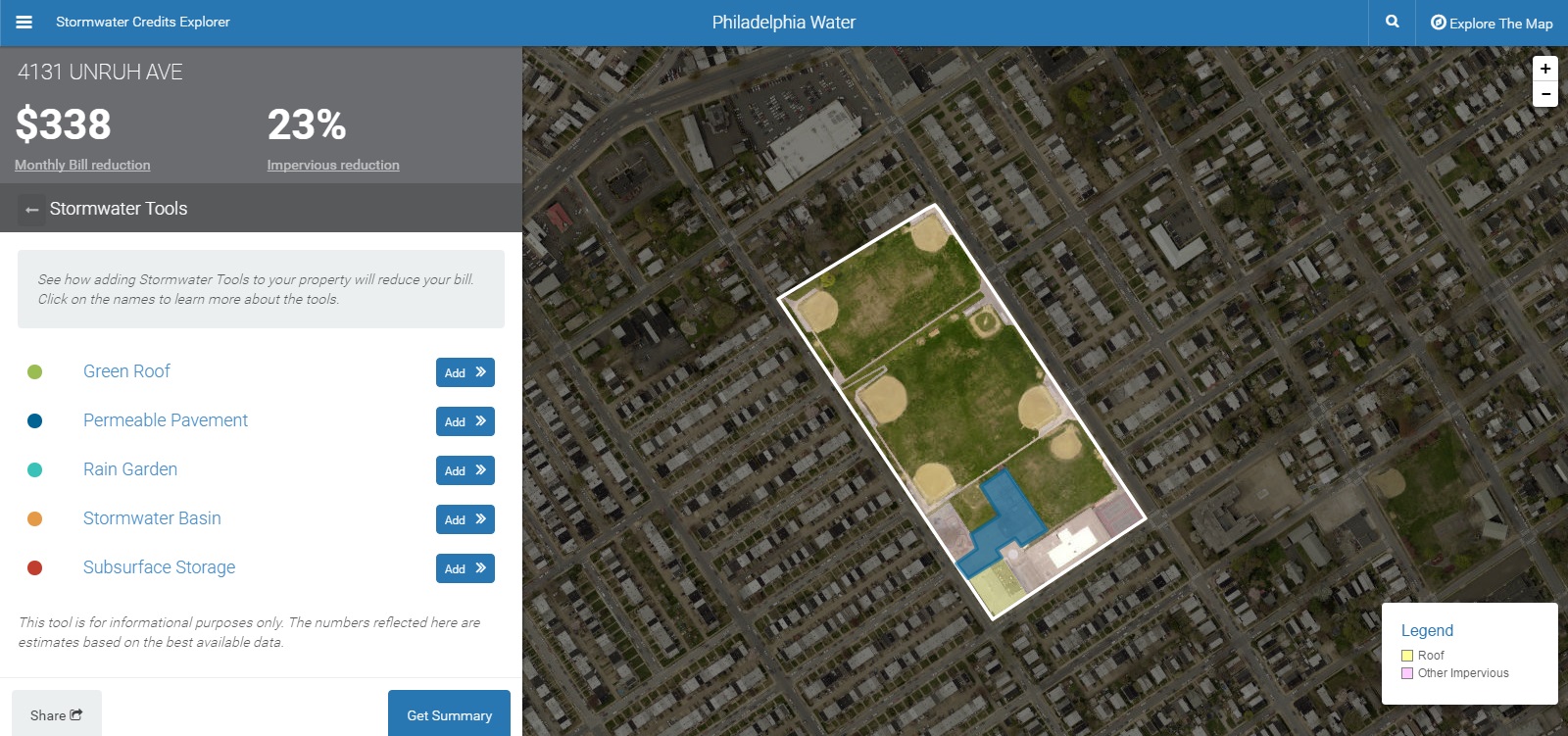
According to the Stormwater Credits Explorer, the Vogt Recreation Center could stand to save about $338 on stormwater management each month if it were to cover about 3250 sq. m. (35,000 sq. ft.) of its outdoor play area with permeable pavement. Photo: Philadelphia Water.
Unlike the National Stormwater Calculator or other visualization tools, Credits Explorer enables users to compare and contrast how even specific placement of new projects within a lot will affect the bottom line, and it requires no input of lot variables before use. The free tool, developed as part of Philadelphia Water’s “Green City, Clean Waters” movement, currently enables users to draw hypothetical green roofs, permeable pavements, rain gardens, stormwater basins, and sub-surface storage areas.
The Internet of Infrastructure
Sporting a collection of cloud-enabled apps configured to work alongside physical sensors installed on existing stormwater systems, OptiRTC, Inc. (Boston, Mass.) provides a suite of tools that can, among other things, cut the necessary amount of stormwater storage space for industrial properties in half.
Based on weather forecast data from the National Oceanic and Atmospheric Administration (NOAA), OptiNimbus™ automatically adjusts settings on cisterns, tanks, valves, ponds, bioretention cells, and more. When NOAA expects rainfall, OptiNimbus predicts the amount of rain that will fall in its area, and manipulates valves and infrastructure controls to minimize runoff discharges during peak flows while at the same time maximizing water harvest potential. In this way, OptiNimbus enables the use of one tank for both stormwater detention and stormwater harvesting instead of two.
Once the storm event has passed, the system slowly releases the stormwater it has collected while considering regulatory requirements, expected future rainfall, pollution potential, and other factors. OptiNimbus, together with two other Opti offerings that enhance the monitoring and predictive maintenance capabilities of stormwater systems, has been implemented in over 130 systems across the U.S. – including at U.S. EPA Headquarters in Washington, D.C.
Mapping a path to better compliance
As state and federal stormwater discharge regulations only stand to become more complex in the coming years, technology startup Mapistry (Berkeley, Calif.) aims to make the navigation of compliance as painless as possible.
Using a mobile app, Mapistry customers enjoy
- easy access to site-specific permitting forms and information,
- the ability to compare water sample data with third-party benchmarks to gauge stormwater system effectiveness,
- step-by-step instructions toward the creation of stormwater pollution prevention plans, and
- extensive financial record-keeping capabilities.
The “map” in Mapistry refers to a feature that enables industrial stormwater managers to model their facilities within the app to enable easy integration into submitted documents. Based on water quality samples, the system also can pre-emptively recommend maintenance steps in line with current regulations.
An around-the-clock team of stormwater and regulatory professionals also is available for Mapistry customers to consult with on permitting information, maintenance recommendations, and legal advice as necessary.