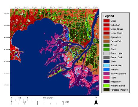
Researchers from the Michigan Tech Research Institute used three-season PALSAR remote sensing data and field information to create a map of the Great Lakes coastal wetlands.
The Michigan Tech Research Institute has developed a comprehensive map of the Great Lakes coastal wetlands. This map is available publicly and is the first of its kind on such a broad scale. It shows more than 16,000 km of shoreline across the entire basin in both Canada and the U.S. The map can help manage wetlands, which are a diminishing resource. According to project leader Laura Bourgeau-Chavez, more than 50% of the Great Lakes’ coastal wetlands have been lost over the last century, and others are being degraded.
The maps are based on site visits and satellite data collected in the spring, summer, and fall using a technique that can distinguish flooded ground, vegetation’s vertical structure, soil moisture, and the total mass of vegetation. Read more.