
About 5.5% of developed land in the lower 48 U.S. states is covered by impervious parking lots, according to a new modeling project conducted by the U.S. Geological Survey (USGS). The project estimates parking lot coverage based on different types of land use for all 3,109 U.S. counties. Jossiano Leal/Pixabay.
According to automotive industry analysts with Hedges & Co. (Hudson, Ohio), there were more than 275 million registered motor vehicles in the U.S. in 2018. Accommodating that number of vehicles requires an enormous network of parking lots, the vast majority of which are made of impervious pavement that rainwater cannot infiltrate.
Until now, researchers have been unable to gauge the full extent of impervious parking lot coverage in a scientifically sound way.
In May, the U.S. Geological Survey (USGS) released a new model that uses land-use data to estimate the amount of land in the lower 48 U.S. states covered by impervious parking lots. Findings from the model could be valuable for urban planners and watershed managers as they plan new developments or retrofit existing areas where runoff pollution is a major issue, according to USGS.
Shopping centers, factories, and airports
Creating a model from real-world parking lot data in every U.S. city would be exceedingly difficult, in part because most cities do not keep track of parking lot coverage. Instead, the USGS team used available data from six cities – Bloomington, Ind.; Chattanooga, Tenn.; Denver, Colo.; Hartford, Conn.; Raleigh, N.C.; and St. Paul, Minn. – to calculate the average percentage of parking lot coverage for 18 different types of land use. The team then used those percentages, along with data about how land use trends have changed over time from a previous USGS modeling project, to estimate parking lot coverage across all 3,109 counties in the contiguous U.S. users can find data from as far back as the 1970s, and from each decade since.
The model estimates, for example, that commercial land has consistently contained the highest percentage of parking lot coverage over the last four decades. In 2012, the model identified just over 12 billion m2 (129.1 billion ft2) of commercial land in the U.S. — about 2.4 billion m2 (25.8 billion ft2), or 20.13%, of which was covered by parking lots. Other types of land use with the most impervious space included industrial and military facilities with 19.58%, and major transportation centers such as train stations and airports with 7.43%.
In all, the model estimates that about 5.5% of all U.S. land was covered by parking lots in 2012, a figure that is growing with each decade.
Proving the model

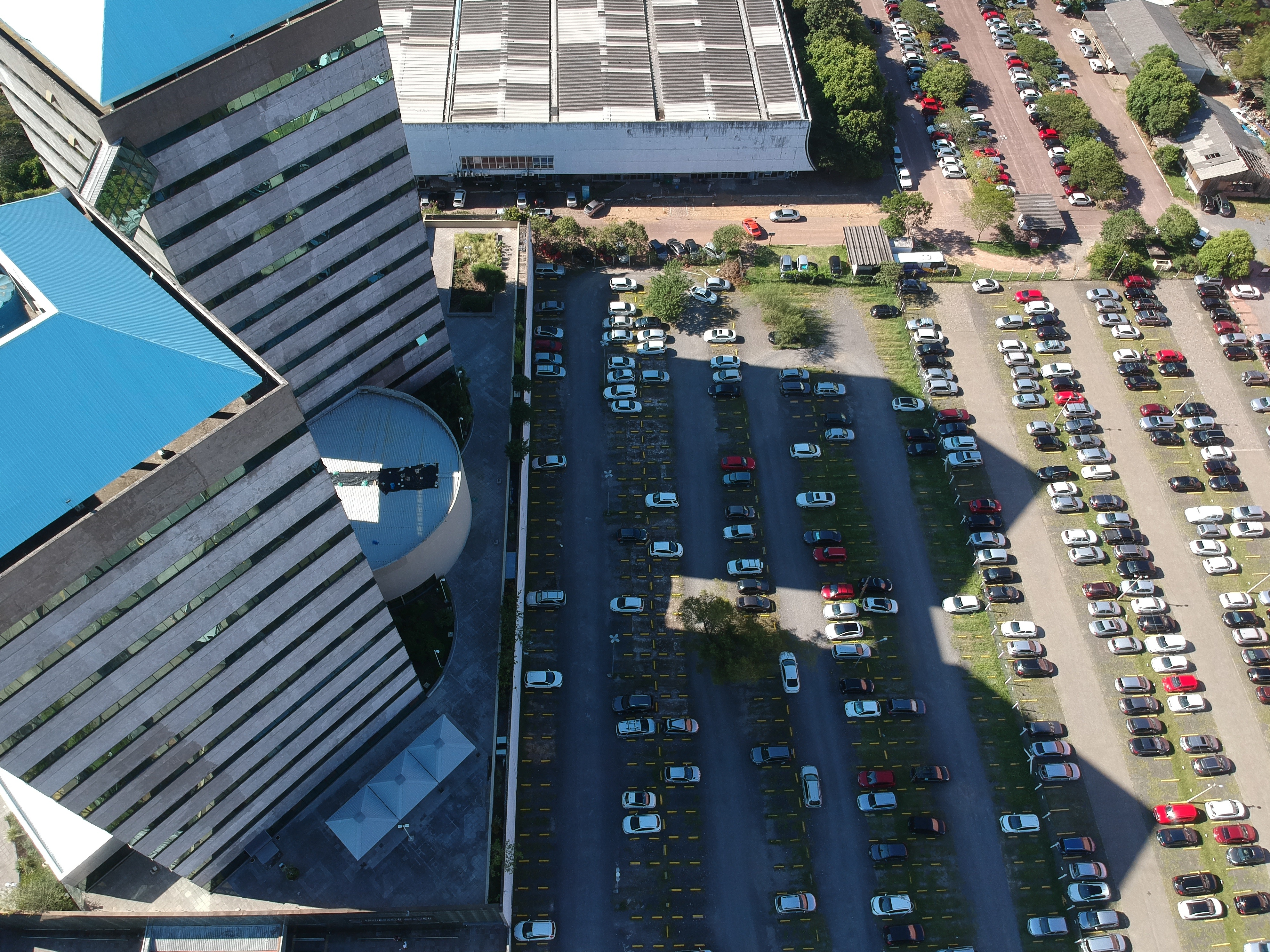
Impervious parking lots can contribute to water pollution when rain carries oil, tire sediments, and heavy metals into waterways via runoff. The ability to estimate the amount of paved land in a city or watershed can help infrastructure and water quality planners decide on new retrofits and interventions, according to USGS. Mike Beezhold/HDR Inc. (Omaha, Neb.).
Having a robust body of data from the six focus cities gave researchers the opportunity to test how well their model’s estimates aligned with real-world parking lot coverage. In all but one case, the model’s estimates were within 1% of actual coverage figures. However, in the case of Hartford, Conn., data was available only for a 14-km2 (5.5-mi2) area, at most one-sixth the size of the next largest study area. The model’s estimates were inaccurate by about 5% in this case.
Researchers say the inconsistency underscores an important point about using the tool: While its estimates of impervious cover are useful for modeling large areas such as cities and watersheds, the data becomes far less useful for study areas smaller than 80 km2 (31 mi2).
See how parking lot coverage in your county has shifted over the last 50 years by exploring the USGS’ newly released datasets.