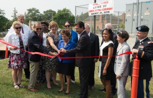
Michigan public officials from state and local government as well as representatives of the Metropolitan Water Reclamation District of Greater Chicago and U.S. Army Corps of Engineers cut the ribbon on the new Levee 37 project. Image provided by MWRD
In September, the Metropolitan Water Reclamation District of Greater Chicago (MWRD) announced the completion of Levee 37, which will help prevent flooding in Des Plaines River communities. The levee will protect more than 600 existing homes and dozens of businesses in Mount Prospect and Prospect Heights from future flooding with an estimated annual savings of more than $3 million in avoided flood damage.
Levee 37 was a collaboration between MWRD, federal leaders, the U.S. Army Corps of Engineers, various other agencies, and northwest suburban communities surrounding the Des Plaines River.
Work on Levee 37 began in spring 2009, but flooding has affected the area for decades. In September 1986, flooding caused an estimated $35 million in damage to 10,000 dwellings and 263 business and industrial sites. More than 15,000 residents were evacuated from the flooded area, and seven lives were lost.
In providing compensatory floodplain storage for the Levee 37 Project on the Des Plaines River, officials also were able to increase stormwater detention at Heritage Park for the village of Wheeling, Ill. Working with the Wheeling Park District, MWRD created six stormwater storage areas with a total capacity of more than 185,500 m3 (49 million gal) and provided recreational improvements at Heritage Park. This Heritage Park Flood Control Facility was MWRD’s first major stormwater construction project since the Illinois General Assembly granted it stormwater management authority in 2004.
Levee 37 is one of six projects to reduce flooding along roughly 130 km (80 mi) of the Des Plaines River, which flows through 33 municipalities in Cook and Lake counties. Federal funding covered much of the $36 million project, which includes a flood warning system and pump station designed to handle interior drainage. A floodwall reaches 2.4 m (8 ft) high in stretches; closure structures equipped with pipes drain landside water; and flap gates prevent backflow from the river.
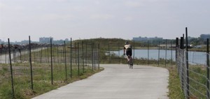
A cyclist enjoys new trails on Northerly Island. Image by the Chicago Parks Department SIDEBAR: Chicago Celebrates Ecological Restoration of Northerly Island Park Also in early September, Chicago Park District celebrated the ecological restoration and opening of Northerly Island Park, which involved the restoration of shoreline habitats, coastal wetland, and other coastal plant communities. The 17-ha (43 ac) project is a green space in the heart of Chicago that protects and enhances Lake Michigan and doubles as an educational campus for children. The park features a 1.6 km (1 mi) multipurpose trail; a 2 ha (5 ac) lagoon that is hydraulically connected to Lake Michigan; nature trails, boardwalks and rolling hills providing views of the city and refuge for migratory birds; native plantings to attract a wide range of birds and insects; camping locations; educational areas for park programming; and a lacustrine shelf along Burnham Harbor to provide fish habitat. In 2013, WEFTEC attendees toured the early development of this site. Read more about it here.